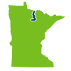
Established in 1963 as a state water trail, the Big Fork River takes its name from the fact that it is the larger of two tributary streams to the Rainy River. The Big Fork was originally known by the Ojibwe as Bowstring River, from its source in the large Bowstring Lake.

PAT Social Media
River segments and maps
Get maps and more information for this river's two segments.
- Dora Lake to Highway 6
- Highway 6 to Rainy River
Landscape
Scattered small farms break up a forest of pine, spruce, fir, cedar, aspen and birch. The geology is clay, silt and sand deposits—in many places less than five feet thick—overlying Precambrian igneous and metamorphic rocks. Most of the watershed was once covered by glacial Lake Agassiz.
History
The area has been a traditional homeland to native peoples for thousands of years. One of the most notable groups was the Laurel. People of this group built Grand Mound, a burial hill 40 feet high and more than 100 feet across at its base. Located near the mouth of the river, the site is part of Grand Mound Center, a Minnesota Historical Society facility.The Laurel gave way to the Blackduck, who may have been the direct predecessors of the Dakota. The Dakota inhabited the region until the Ojibwe laid claim to the area.At the turn of the century, millions of board feet of pine logs were floated down the river to lumber mills in Ontario.Established in 1963 as a state water trail, the Big Fork River takes its name from the fact that it is the larger of two tributary streams to the Rainy River. The Big Fork was originally known by the Ojibwe as Bowstring River, from its source in the large Bowstring Lake.


